

Capture discontinuities, geological features, and structural observations directly at the face.

Capture discontinuities, geological features, and structural observations directly at the face.

Capture discontinuities, geological features, and structural observations directly at the face.

Capture discontinuities, geological features, and structural observations directly at the face.

Capture discontinuities, geological features, and structural observations directly at the face.

Capture discontinuities, geological features, and structural observations directly at the face.

Capture discontinuities, geological features, and structural observations directly at the face.
Capture discontinuities, geological features, and structural observations directly at the face.
Capture discontinuities, geological features, and structural observations directly at the face.
Capture discontinuities, geological features, and structural observations directly at the face.
Capture discontinuities, geological features, and structural observations directly at the face.
Capture discontinuities, geological features, and structural observations directly at the face.
How ready is your workflow?
Answer 3 questions about how your team captures, manages, and uses underground data. Get an instant readiness score and integration roadmap.
Workflow Analysis
PDF DELIVERED
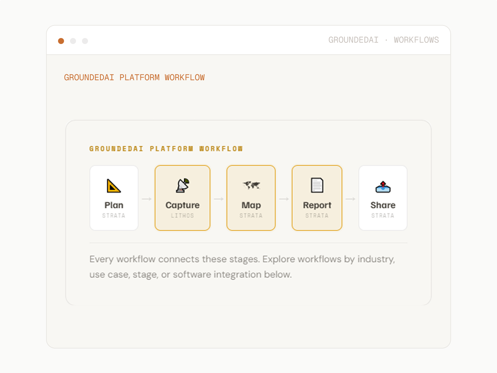
Every Data Process is optimized for the specific technical and operational challenges of subsurface environments.

For mining and exploration geologists. Capture structural and lithological data underground with Lithos. Strata structures it and exports geological boundaries, structural orientations, and discontinuity sets straight into your Leapfrog Geo model every week, not every quarter.

For tunnelling and civil engineers. Capture ground conditions chainage by chainage with Lithos. Strata structures the data for design validation, RES reviews, and BIM handoff in Leapfrog Works so the model your team relies on reflects what's actually been excavated.

For mine planners. Capture geological and geotechnical observations as production advances. Strata structures and exports them as Deswik-ready datasets closing the gap between what's in the plan and what's actually in production.

For geotechnical engineers. Capture discontinuity geometry and orientation data underground with Lithos. Strata structures and exports rock mass classifications and stability inputs in Rocscience-compatible formats so engineers iterate on scenarios instead of retyping data.

For specialists running FLAC or 3DEC. Capture classification data and discontinuity geometry underground. Strata structures it into Itasca-ready inputs so model parameterisation starts with measured underground data, not reconstructed estimates.

From underground to the office. Keep geology, geotech, and planning aligned.

Share scans on the big screen in a meeting. Teams can align on support requirements in minutes.

Rapid face mapping captures geology and structure every round. The next shift starts with the record, not a verbal handover.
If your team captures geological data today, we can help you turn it into clarity tomorrow.

30 minutes, focused on your current workflow.
Tailored to your industry.
No commitment required.

© 2026 GroundedAI. All rights reserved.
Vancouver, BC · EN


