NEWSLETTER


Capture creates the record; Map organizes it; Decide uses it. Teams that turn the datasets into decisions to make the most of what's captured underground.

The record sits there; decisions get made on informal conversations, handover notes, and personal recollection. The record exists but doesn't drive decision making.
Three stages. One product. One connected workflow from face to decision.
Annotated 3D datasets and historical comparisons, team-wide access to the same information.

%20-%20Banner.png)
Multi-user access, discussion anchored to specific observations. The RES meeting, the engineering review, the ground-control board all can make decisions from here.
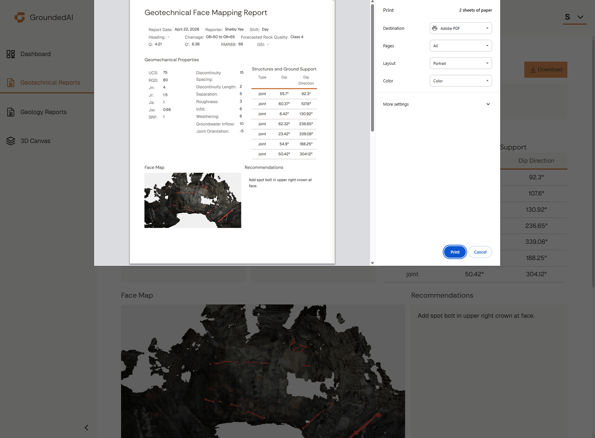
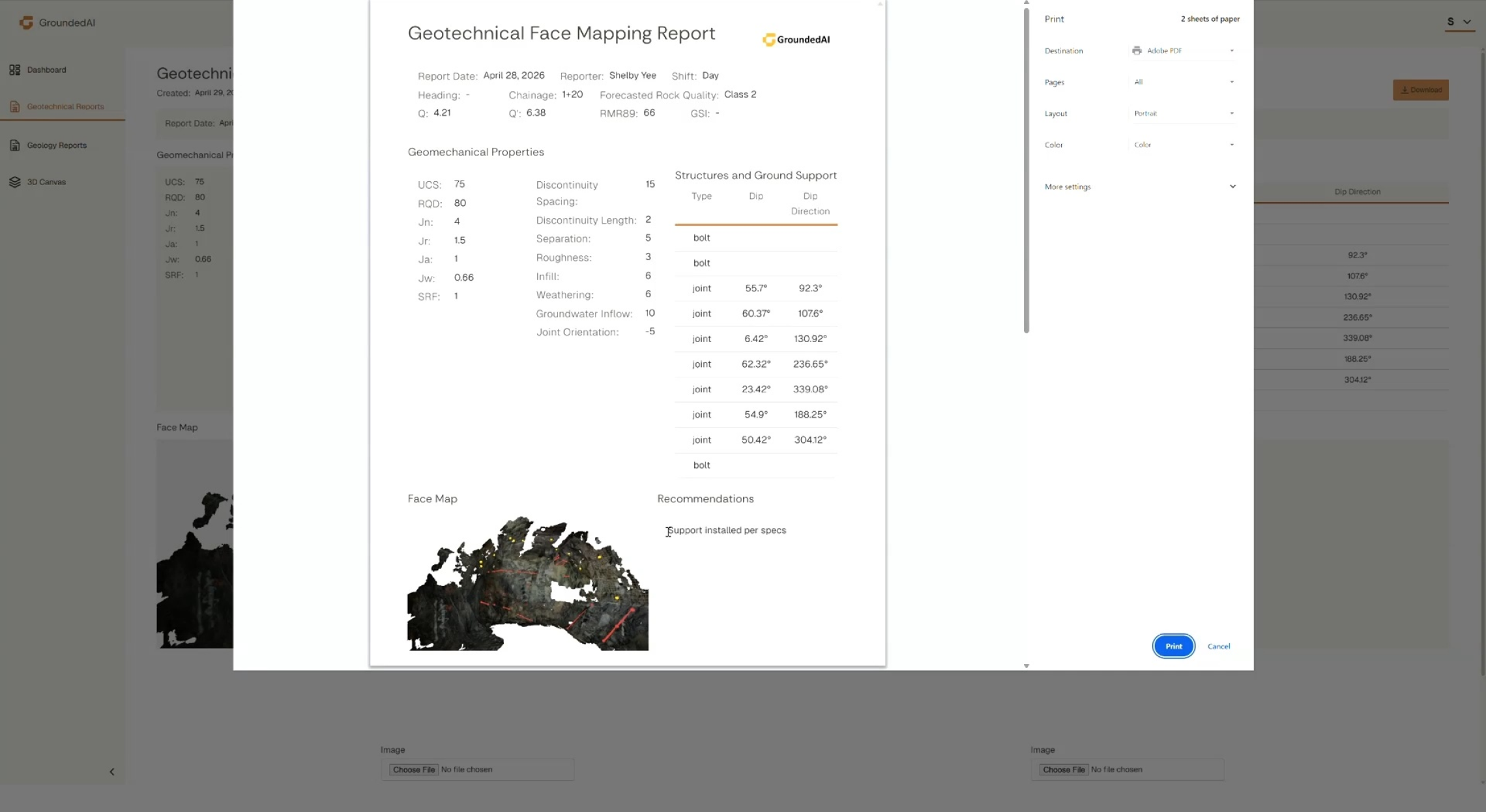
Spot bolt locations, support-class calls, ore-boundary decisions, rehabilitation triage. The decision record stays tied to the report and data it was made on.

Plan, Capture, and Map contribute to it; Decide is where the a report is generated and records become useful.
Decisions tied to datasets and observation, time-stamped with observer attribution from generated reports.

Data captured in Lithos flows directly into the Grounded platform, where teams can review conditions, generate reports, and align on decisions.


Walk through a decision workflow with a real project scenario.

© 2026 GroundedAI. All rights reserved.
Vancouver, BC · EN


