
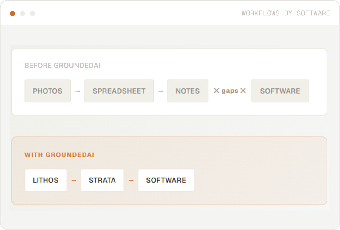
GroundedAI does not replace your modelling or engineering software. It changes what happens before data reaches those tools.
Instead of working from disconnected photos, spreadsheets, and notes, teams start with structured, geolocated observations that are ready to use.

Capture 3D scans, photos, and annotations directly underground. Offline. Structured from the moment of capture.


Georeference, map, and organize observations into a shared dataset. Review and validate before export.

Deliver structured data into Leapfrog, Deswik, Rocscience, or Itasca in compatible formats.
Exports to industry-leading software


Each data process connects field observations captured in Lithos and structured in Strata to a specific modelling or analysis tool. Select your software to see how it works.
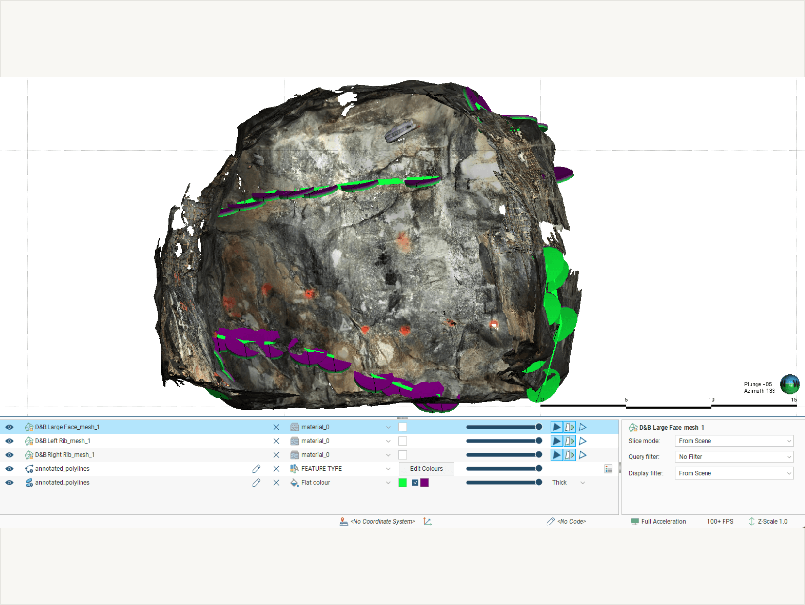
Geologists capture lithology, contacts, and structural features underground with Lithos. Observations are structured and georeferenced in Strata, then exported directly into Leapfrog for 3D geological modelling. No manual digitizing. No lost context between the face and the model.
What flows into Leapfrog GEO:

Lithological contacts and geological boundaries.
Structural measurements (x,y,z, dip, dip direction).
Georeferenced annotations with metadata about geological features.
Textured meshes, photos, and annotations.

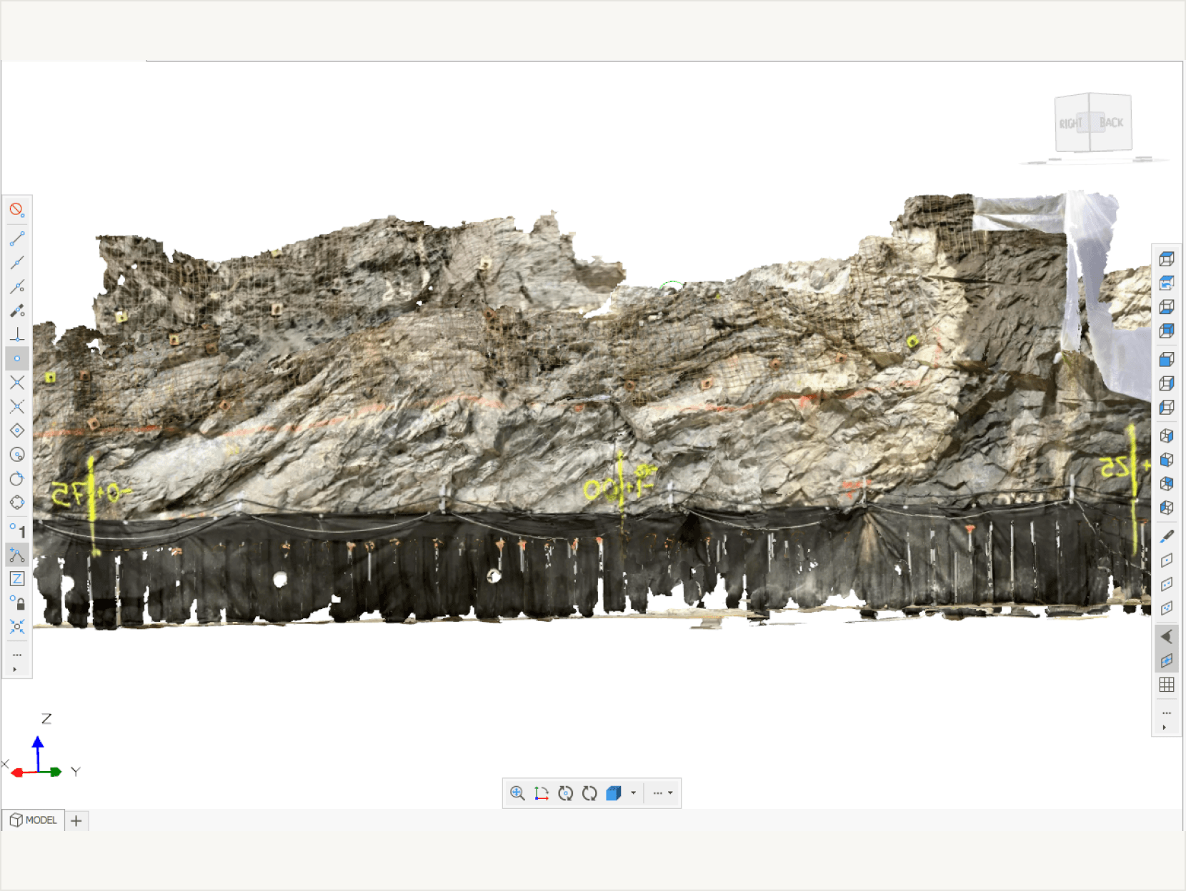
For tunnelling and civil engineers. Capture ground conditions chainage by chainage with Lithos. Strata structures the data for design validation, RES reviews, and BIM handoff in Leapfrog Works so the model your team relies on reflects what's actually been excavated.
What flows into Leapfrog Works:
Development inspection records
Ground support observations and compliance data.
Geological contacts relevant to ore boundaries.
As-built documentation for planning reconciliation.

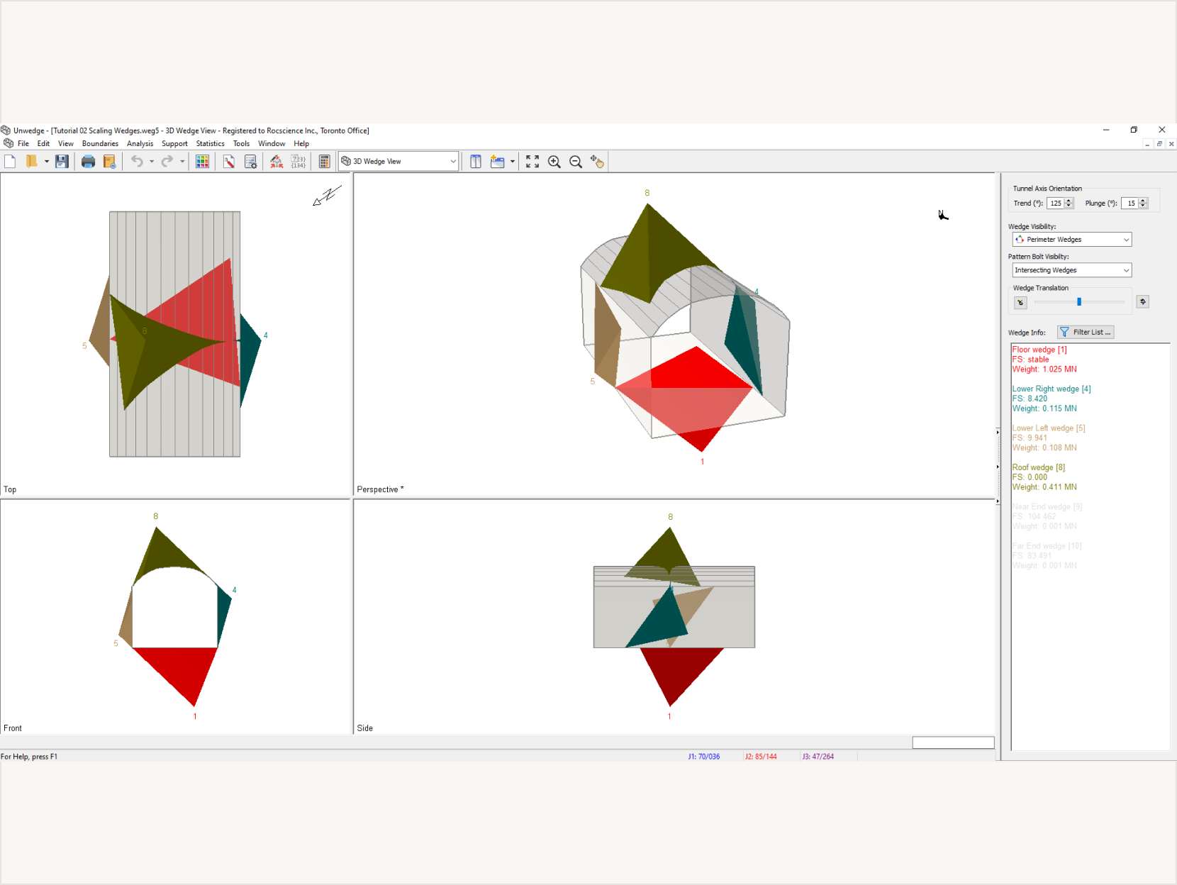
Geotechnical engineers capture discontinuity data, rock mass ratings (RMR, Q, GSI), and ground condition observations with Lithos. Strata validates and structures this data, then exports it into Rocscience tools for wedge analysis and support design.
What flows into Rocscience:
Discontinuity orientations.
Rock mass classification inputs (RMR, Q, GSI).
Ground condition records for design verification.

Field teams capture ground conditions, face mapping, and support observations with Lithos. Strata structures this data into planning-ready datasets, structural models, ground conditions, and geological contacts that flow directly into Deswik for design and scheduling.
What flows into deswik:
Rock mass property inputs for numerical models.
Structural feature geometry and orientation.

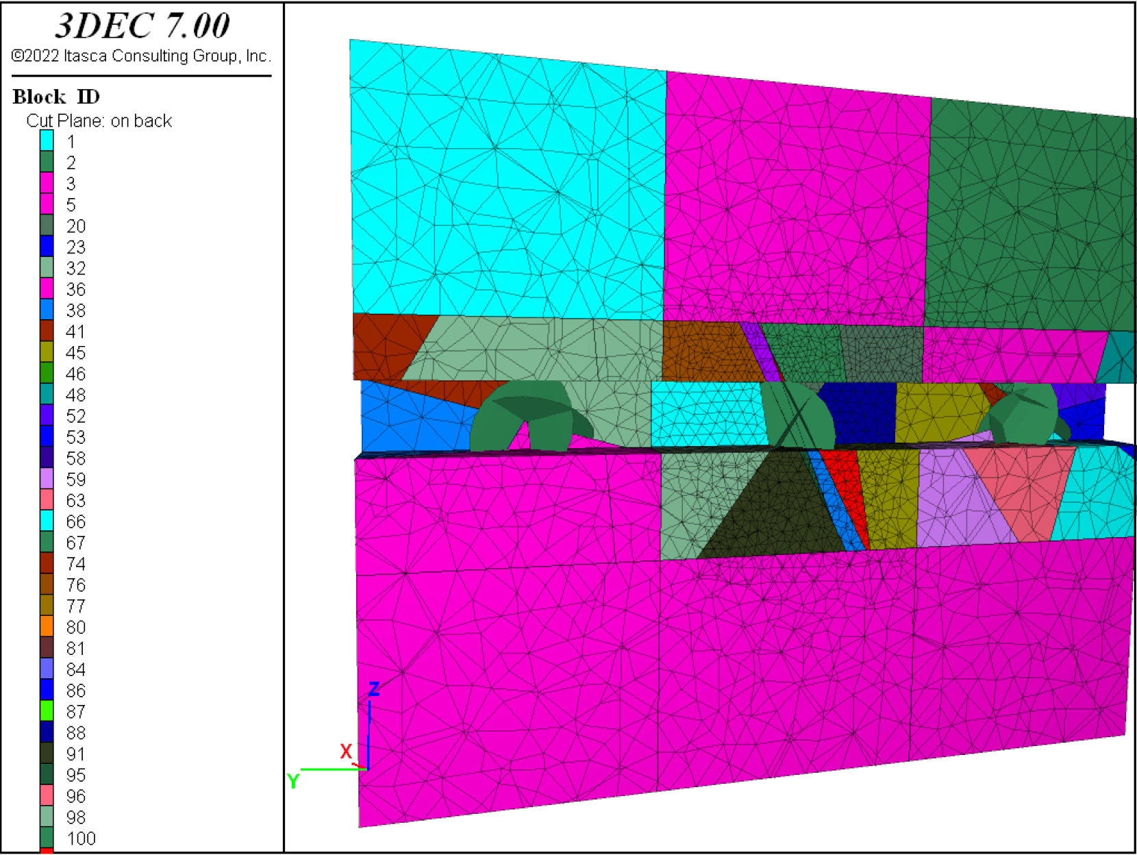
Teams capture detailed ground condition observations, rock mass properties, structural features, and deformation indicators with Lithos. Strata structures this data for export into Itascaʼs numerical modelling tools (FLAC, 3DEC, PFC), providing field-validated inputs for complex geomechanical analysis.
What flows into Itasca:
Specialists running FLAC or 3DEC.
Data and discontinuity geometry underground.
Inputs for complex geomechanical analysis.
For projects standardised on AutoCAD, GIS, or any system that accepts open formats. Strata exports structured underground data as DXF, CSV, and OBJ one capture pipeline, every downstream destination, no vendor lock-in.
What flows into Open AutoCAD:
AutoCAD, GIS, or any system that accepts open formats.
Structural underground data as DXF, CSV, and OBJ.
When modelling starts with structured, field-validated observations instead of assumptions and re-entered data, teams spend less time cleaning inputs and more time making decisions.
The gap between whatʼs observed underground and what reaches your modelling software is where errors, delays, and rework live. GroundedAI closes that gap.


Modelling starts with structured, validated field data, not assumptions rebuilt from photos.


Field data reaches modelling software within the same shift, not days or weeks later.


No manual format conversion, no re-entry, no interpretation gaps between capture and analysis.
These software workflows support the same operational decisions teams make every day. Explore how they connect to specific use cases.
Data captured in Lithos flows directly into the Grounded platform, where teams can review conditions, generate reports, and align on decisions.


Strata exports are compatible with software including Leapfrog Geo, Leapfrog Works, Deswik and any other CAD-related software. Rocscience and Itasca are supported via open formats (DXF, CSV).
No. GroundedAI is typically used before modelling. Our software captures and structures the underground data that improves those tools. We don't focus on modeling or planning, we focus on gathering and structuring the data to improve the software downstream.
If your team uses modelling or engineering tools today, we can show you how the Grounded Platform improves the data that flows into them.

30 minutes, focused on your current workflow.
Tailored to your industry.
No commitment required.

© 2026 GroundedAI. All rights reserved.
Vancouver, BC · EN


