NEWSLETTER


A dataset that can't leave the system is a dataset the project can't fully use. Modelling happens in Leapfrog. Planning happens in Deswik. Analysis happens in Rocscience or Itasca. Reports in PDFs. The data needs to reach all of these locations seamlessly in slightly different formats.

Manual export and reformatting between systems leads to data loss. Coordinates drift. Attributes get dropped. The downstream analysis runs on a degraded version of what was captured underground.
Three stages. One product. One connected workflow from face to decision.
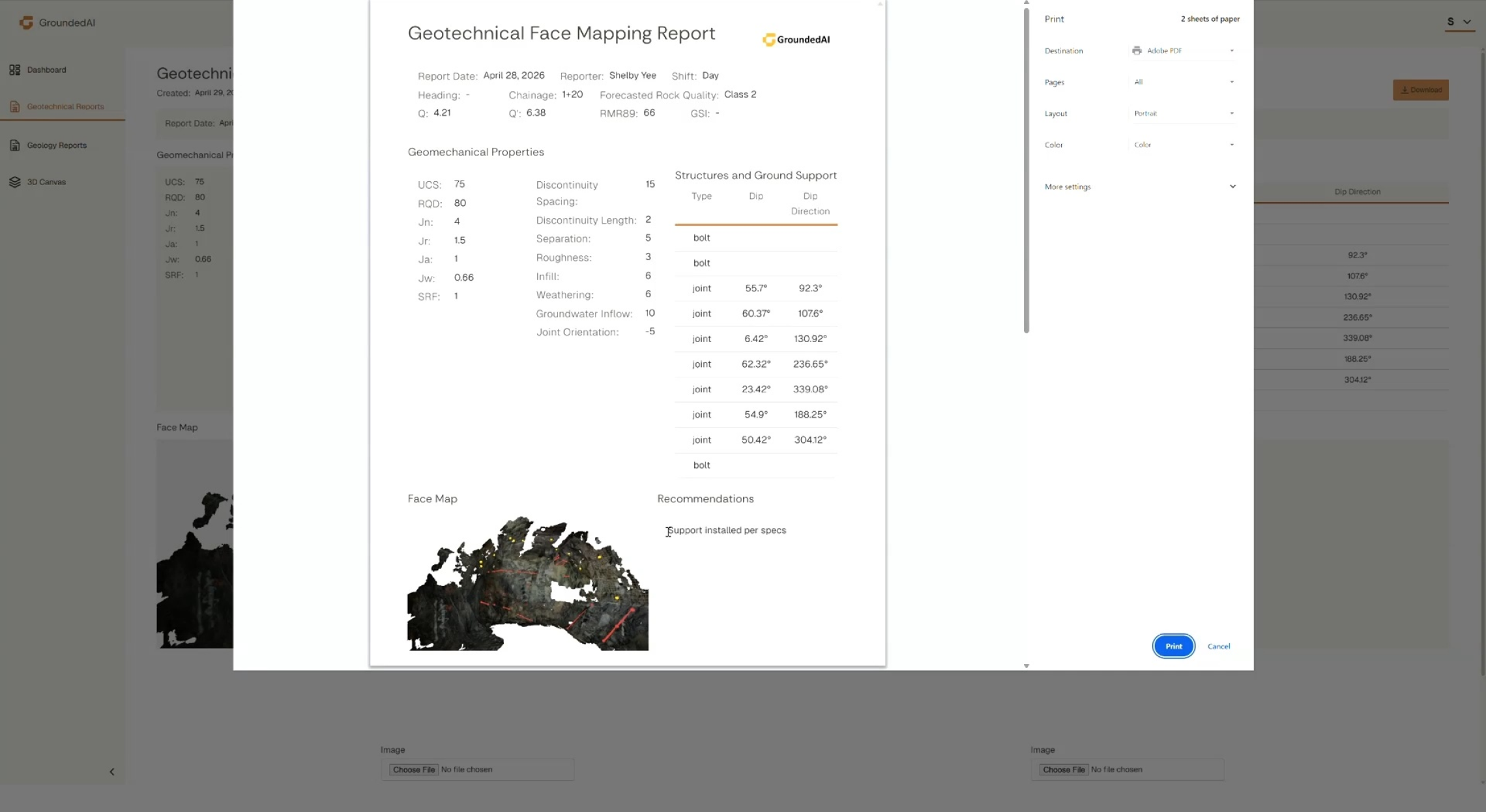
Generated structured reports. Geological mapping reports, geotechnical assessment reports. Customizable report templates per project (coming soon).

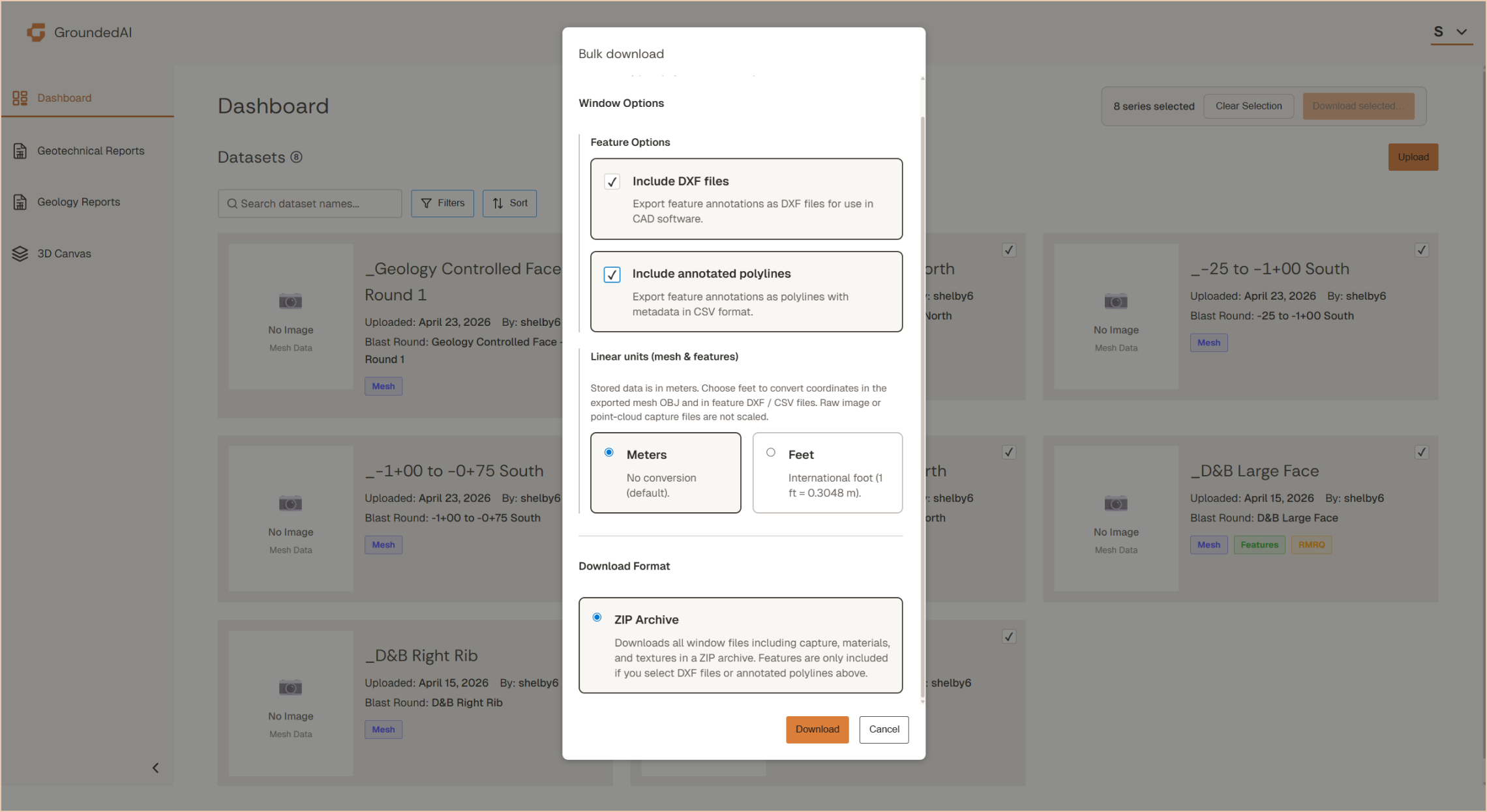
Native export to Leapfrog, Deswik , and open formats (DXF + CSV + OBJ) for any other downstream consumer.
DXF, CSV, OBJ for CAD, GIS, Rocscience, Itasca, and any system that accepts open formats.


Datasets compatible with the software you already use, including Leapfrog, Deswik, Vulcan, Rocscience software, Itasca software, AutoCAD, and more. Structured PDF reports easily sharable by email.

Data captured in Lithos flows directly into the Grounded platform, where teams can review conditions, generate reports, and align on decisions.


Walk through an export workflow with your downstream tools in mind.

© 2026 GroundedAI. All rights reserved.
Vancouver, BC · EN


