NEWSLETTER


Ground doesn't stay static. Support systems age, loads shift, and excavations respond. For most mining operations, damage mapping is a critical routine. When damage goes undocumented, rehabilitation gets prioritized by the loudest voice rather than the worst condition. When it's documented sporadically, the pattern of deterioration stays invisible until it becomes a significant risk or something fails.
How systematically data was captured can significantly impact how effective the rehab program is.

Damage mapping can be triggered by an incident, a near-miss, or a visual inspection that picks up an obvious problem. The records are typically photos, notes in notepads, and conversations between the geotechnical engineer and shift superintendent. Scheduling rehabilitation competes with the pace of production and availability of equipment.
It gets done when it becomes urgent, not when it's optimal.
Five stages. Two products. One connected workflow from face to decision.
Define the damage-mapping regions and cycle using starred locations. Determine which locations and which support systems need to be monitored. Configure Lithos capture profile for damage-specific annotation (support condition and ground support types).

Capture a 3D scan of the affected area and compare against historical data while underground. HD photo annotation of damaged features. Classification of damage type, severity, and urgency. Time-stamped, georeferenced, observer-attributed.
Damage records sync to Strata where data is georeferenced and compared against previous captures where available.

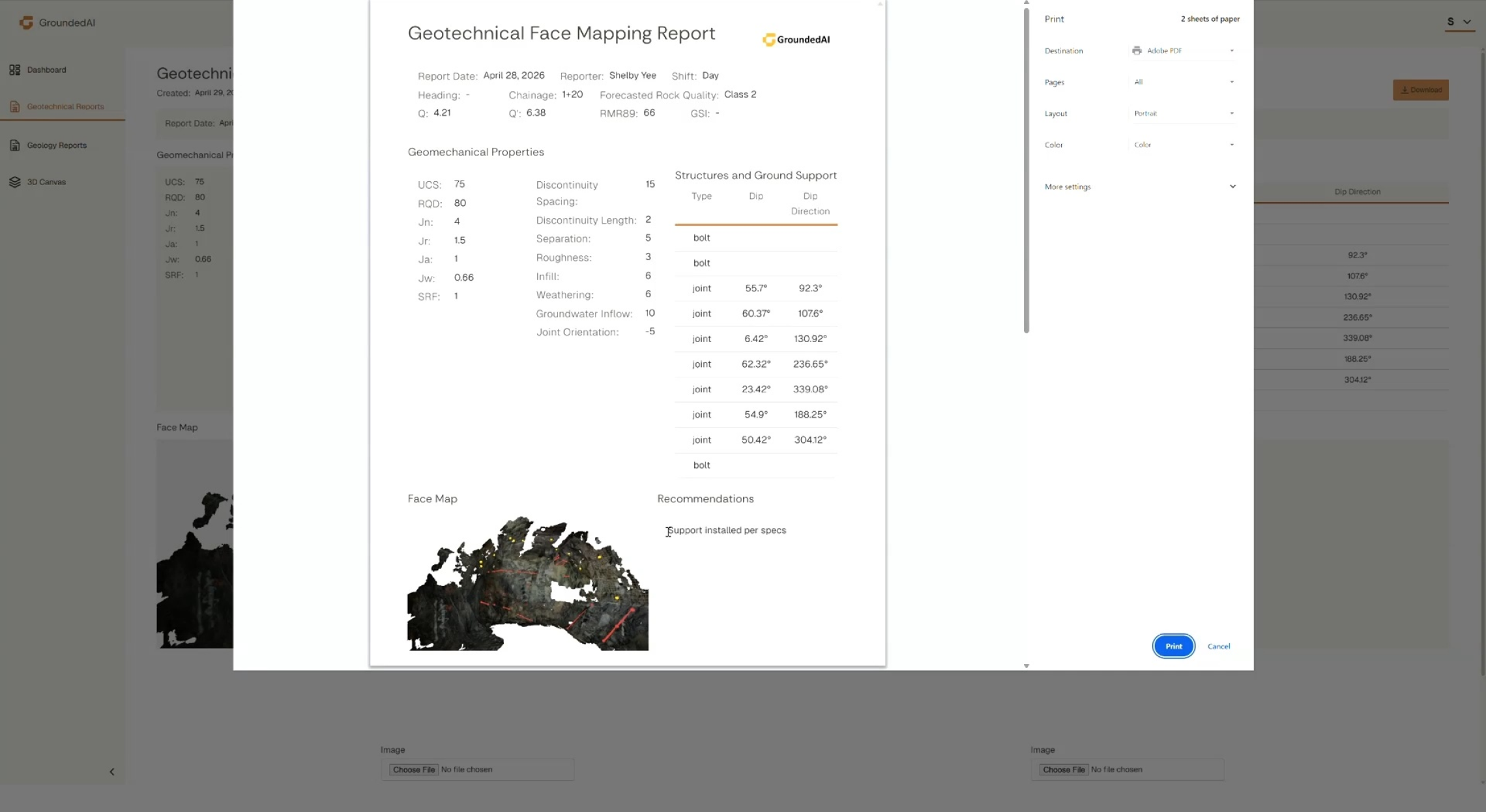
Share reports documenting severity, urgency, and location to drive the work that needs to be completed. Engineering teams can use the current damage record compared to the historical record to prioritize support-system rehabilitation.
Export the damage record for rehabilitation planning, safety reviews, and reconciliation. Feed the damage pattern back into geotechnical assessment workflows and mine planning.


Document deteriorating ground conditions and ground support damage in 3D over time. Review current conditions to historical data captured in the same location.

Damage records compared against historical datasets from previous captures. Identify visible patterns and changes over time. Generate reports based on urgency and severity to prioritize rehab.
Damage records with damage type, severity, location, and timestamped. Reconciliation datasets comparing today's conditions vs.historical conditions. A persistent damage history that helps prioritize rehab work and risk management.

Data captured in Lithos flows directly into the Grounded platform, where teams can review conditions, generate reports, and align on decisions.


Walk through a full damage-mapping cycle with a mining scenario.

© 2026 GroundedAI. All rights reserved.
Vancouver, BC · EN


