NEWSLETTER


Structural mapping informs how the ground will behave. Every excavation plan, support design, and sequencing decision depends on understanding what structures are present, where they are, and how they're oriented.
When structural documentation is incomplete or arrives late engineers fill the gap with assumptions. Those assumptions carry risk into every decision that follows.


Most structural observations still start on paper or in photos with minimal spatial context. Orientation data is estimated, not measured. Observations are transcribed into spreadsheets or modelling software manually and every transcription step loses detail.
By the time a structural model is updated, the face has moved on. The geological record is always catching up. Teams reviewing conditions are working with yesterday's data to make today's decisions.
The result: engineering decisions that should be based on structural evidence are based on structural interpretation filtered through multiple handoffs and an outdated model.
Five stages. Two products. One connected workflow from underground to decision.
Set which features need to be mapped per zone, what classification system applies, and who reviews the data. Strata holds the capture protocol so every field team works from the same brief.
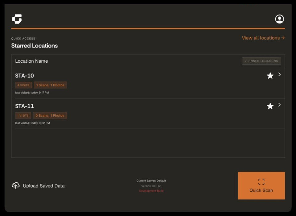
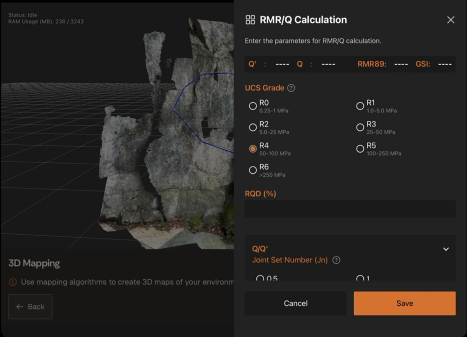
At the face, scan and annotate structural features directly on the iPad. Record discontinuity orientation, persistence, spacing, and surface conditions. Lithos works offline underground data syncs automatically when connectivity returns.
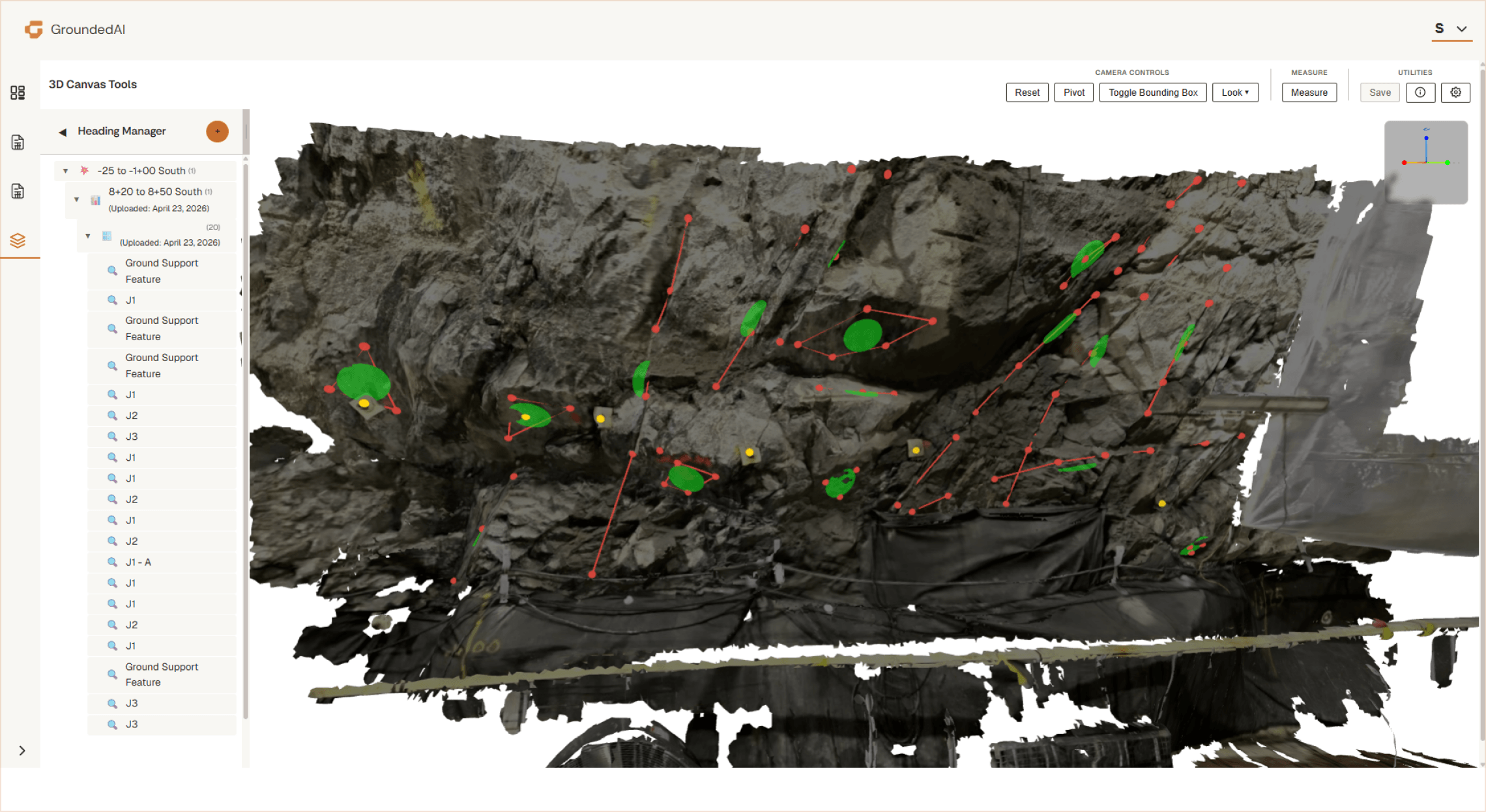
Captured observations are georeferenced and structured into a 3D model. Strata classifies features by type, filters by zone or cycle, and builds the cumulative structural record that grows with the project.


Engineering teams review structural data in Strata with full spatial context. Compare current conditions to the geological model. Identify patterns, anomalies, or changes that affect excavation planning or support design. Document the decision.
Export structural datasets to modelling software Leapfrog, Deswik, or open formats (DXF, CSV). Generate reports for design reviews, regulatory submissions, or project documentation.


Scan and annotate structural features directly underground. Measure discontinuity orientation with 3D spatial accuracy. Classify features using project-defined systems.
Capture offline. Every observation is time-stamped, georeferenced, and attributed to a specific location and cycle. The capture record is immutable.

Every captured observation arrives with its spatial context intact. Classify, filter, and organize structural features across the entire project. Build the cumulative model that engineering teams reference for every downstream decision.
Review captured conditions as soon as they're synced not hours or days later.
Data captured in Lithos flows directly into the Grounded platform, where teams can review conditions, generate reports, and align on decisions.


Walk through the complete workflow with your project in mind. We'll show you how Lithos captures structural data underground and how Strata makes it available to your engineering team in a 30-minute demo.

© 2026 GroundedAI. All rights reserved.
Vancouver, BC · EN


