

Data is captured in the field, interpreted somewhere else, and rebuilt again for reporting. By the time a decision is made, itʼs too late for the speed of operations.


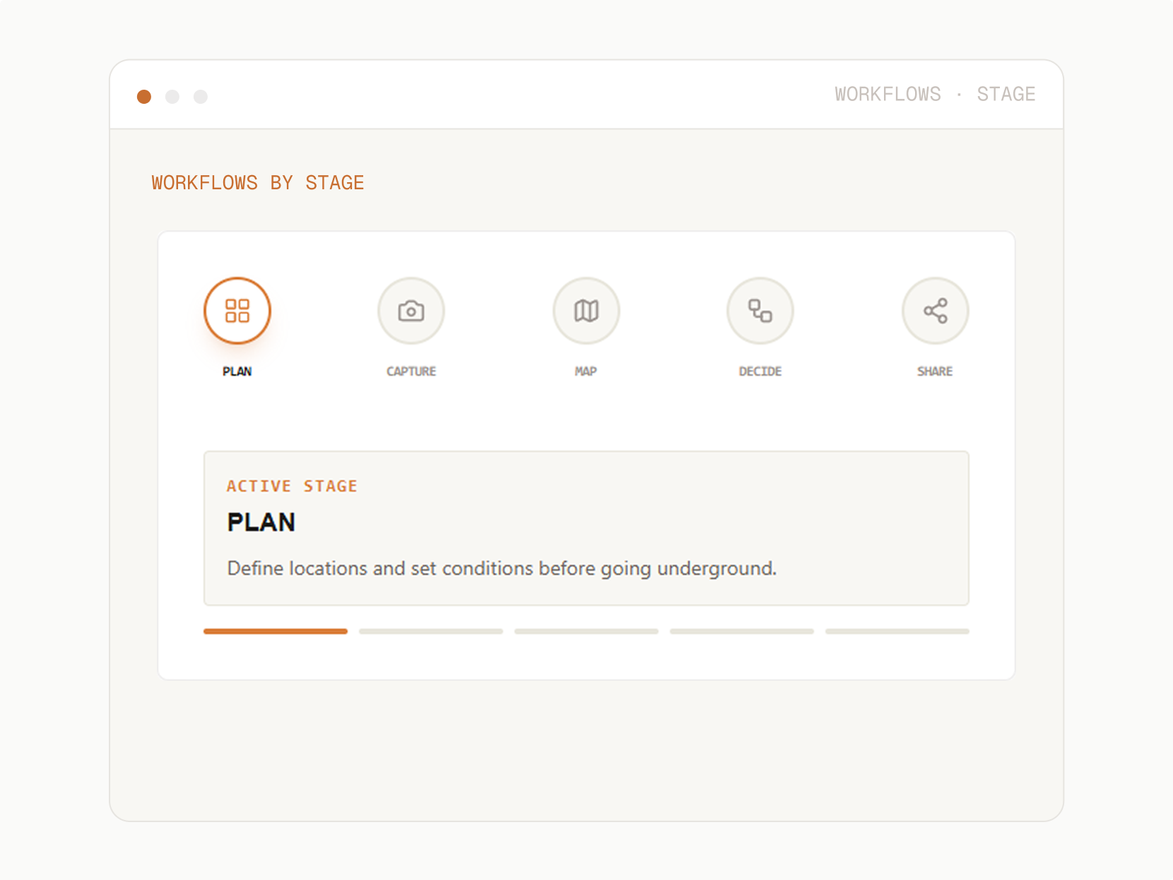
GroundedAI removes these disruptions. Each stage flows to the next, so teams work from one record from the underground to the meeting room
Define and favourite locations, set the conditions that need to be observed. When teams know what to capture and whatʼs been captured before they arrive, every trip to the field is maximized.
Location Management: Configure your locations underground. Infill site-specific observations. View historical visits across the team.

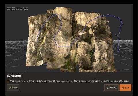
Use Lithos to capture 3D scans, photos, and notes directly at the face. No setup required. No connectivity required. Observations are structured from the moment theyʼre recorded, so nothing is lost between shifts.
3D + Photo Capture: Accurate mesh models, high-resolution photos, and contextual notes - all captured together.
Offline by Default: Designed for underground environments. Capture without connectivity and sync when ready.
Import Existing Scans: Sync 3D data from third-party scanners or existing point clouds directly into the platform.
Location Context: Every observation is tied to heading and chainage automatically.
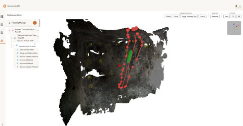
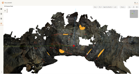
Georeference captured data. Annotate visible features in a consistent format that teams can review and build on, not just interpret from photos.
Georeferencing: Align captured observations with location and design context so data isspatially accurate.
Mapping: Annotate underground conditions directly within the platform. Structure observations into consistent, comparable datasets.

Review captured and mapped data with engineers, managers, and stakeholders in a shared view. Compare actual conditions against the plan. Identify deviations early and make support decisions with the full picture.
Review & Collaborate: Engineers and managers review the same data in real time. No reinterpretation required.
Compare to Plan: See where actual conditions differ from expected GBR, block models, design assumptions, or previous rounds.
Generate structured reports directly from captured data. Export into modelling tools like Leapfrog, Deswik, and AutoCAD. The evidence trail is built in.
Reporting: Generate reports that capture observations, decisions, and conditions digitally.
Data Transfer: Export structured data into modelling and design software. No format conversion. No re-entry.
Define and favourite locations, set the conditions that need to be observed. When teams know what to capture and whatʼs been captured before they arrive, every trip to the field is maximized.
Location Management: Configure your locations underground. Infill site-specific observations. View historical visits across the team.
Use Lithos to capture 3D scans, photos, and notes directly at the face. No setup required. No connectivity required. Observations are structured from the moment theyʼre recorded, so nothing is lost between shifts.
3D + Photo Capture: Accurate mesh models, high-resolution photos, and contextual notes - all captured together.
Offline by Default: Designed for underground environments. Capture without connectivity and sync when ready.
Import Existing Scans: Sync 3D data from third-party scanners or existing point clouds directly into the platform.
Location Context: Every observation is tied to heading and chainage automatically.
Georeference captured data. Annotate visible features in a consistent format that teams can review and build on, not just interpret from photos.
Georeferencing: Align captured observations with location and design context so data isspatially accurate.
Mapping: Annotate underground conditions directly within the platform. Structure observations into consistent, comparable datasets.
Review captured and mapped data with engineers, managers, and stakeholders in a shared view. Compare actual conditions against the plan. Identify deviations early and make support decisions with the full picture.
Review & Collaborate: Engineers and managers review the same data in real time. No reinterpretation required.
Compare to Plan: See where actual conditions differ from expected GBR, block models, design assumptions, or previous rounds.
Generate structured reports directly from captured data. Export into modelling tools likeLeapfrog, Deswik, and AutoCAD. Theevidence trail is built in.
Reporting: Generate reports that capture observations, decisions, and conditions digitally.
Data Transfer: Export structured data into modelling and design software. No format conversion. No re-entry.
The same connected workflow supports everyone involved in an underground operation - from the geologist at the face to the commercial manager reviewing claims documentation.

Capture conditions quickly without losing information.
What they need
Speed, offline reliability, optimized time underground.

Review structured data and make support or design decisions.
What they need
Consistent, validated observations with location context.

Track deviations from plan and build defensible records.
What they need
Reports and clear evidence trails.

See current conditions and understand operational risk.
What they need
Shared views and fast communication from the field.
Strata handles mapping, decision-making, and reporting.Data flows between them with Wi-Fi connectivity.

Fewer delays from unclear or missing ground conditions.
Faster response when conditions change from what was expected.
Stronger documentation for claims and engineering reviews.
Less rework across teams and shifts.
Decisions that are traceable from observation to report.
GroundedAI doesnʼt just capture data. It makes decisions traceable
If your team captures field data today, we can show you how the Grounded Platform connects every stage, from capture to decision to report.

30 minutes, focused on your current workflow.
Tailored to your industry.
No commitment required.

© 2026 GroundedAI. All rights reserved.
Vancouver, BC · EN


