
%20-%20Banner.png)

Geotechnical assessment is a job that delivers the most value when it's repeatable. Using the same approach to capture geotechnical data every week over several months and years helps provide a better picture on how the ground is behaving. That's the signal ground-control decisions depend on.


Geotechnical assessments are captured underground, but the records are stuck in excel sheets or notebooks. Different engineers apply and interpret conventions differently. Photographs get buried in cell phones or individual folders. When the senior geotech tries to answer "how has this drift changed over the last quarter?" or "does this ground support design match our ground control management plan", the decision relies on a conversation rather than the data.
Five stages. Two products. One connected workflow from face to decision.
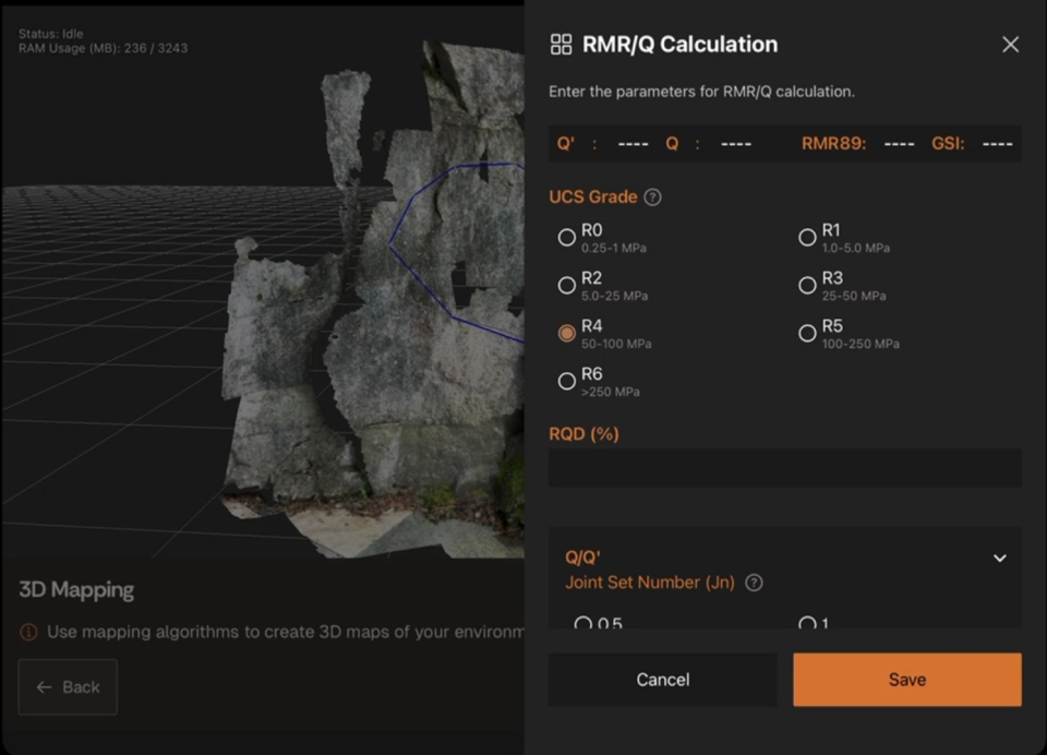
Define the structure of the rock mass assessment. headings, which framework (Q, RMR, GSI), captured and which intervals. Configure Lithos to match the assessment's requirements.

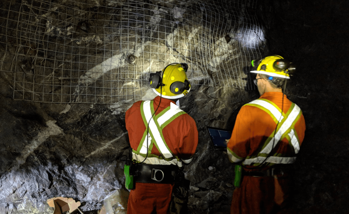
Run the assessment underground. Location-based 3D scans in less than five minutes. Rock mass classification applied in context. Photographs linked to their spatial location.
The underground dataset syncs to Strata, where it's georeferenced, mapped, and organized. Structural features, discontinuities, and condition observations annotated directly on the mesh. Spatial relationships preserved. The assessment is queryable the same day it's captured.


View data against previous assessments or within the same scene as other geotechnical data. Trends in rock mass rating, discontinuity condition, and ground behavior become visible. Support and rehabilitation decisions made against current, comparable data.
Export findings in open formats for structural modeling (Leapfrog, Vulcan), stability analysis (Rocscience, Itasca), share with project stakeholders, feed into support-design reviews and RES meetings.


Use Lithos to capture geotechnical data underground with spatial context and standardized rock mass classification schemes. What's recorded in the field is what enters the record or model.

View datasets, geotechnical assessments, and perform structural mapping. The assessment record builds overtime to strengthen structural models, kinematic analysis, and finite element analysis.
Structured geotechnical assessment records with rock mass classification values, discontinuity data, and condition observations. Comparable datasets across the project lifecycle. Exportable in open formats (DXF, CSV) for downstream analysis. A persistent assessment record that survives personnel change and project handover.

Data captured in Lithos flows directly into the Grounded platform, where teams can review conditions, generate reports, and align on decisions.


Walk through a full assessment cycle with your site in mind.

© 2026 GroundedAI. All rights reserved.
Vancouver, BC · EN


