NEWSLETTER


The geotechnical engineer's job is to observe current ground conditions and assess if and how they have changed. That means comparing assessments overtime with clear documentation of what changed, when, and where.
When previous assessments are not comparable to the current one, continuity is lost with observations over time. Decisions about support, rehabilitation, or ground control are made based on memory rather than data.
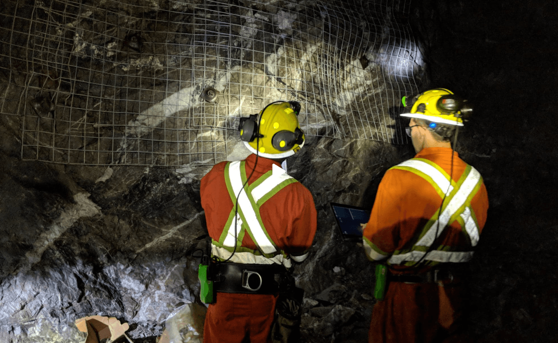


Different engineers, different conventions, different levels of detail. Photos captured from different angles and aspects with scribbled notes. When someone asks "how have conditions in this drift changed over the last six months?", the answer is almost always a conversation, not a dataset.
Three stages. Two products. One connected workflow from face to decision.
Rock mass classification, geotechnical observations, and ground support conditions captured in context. Every assessment is a comparable record over time.
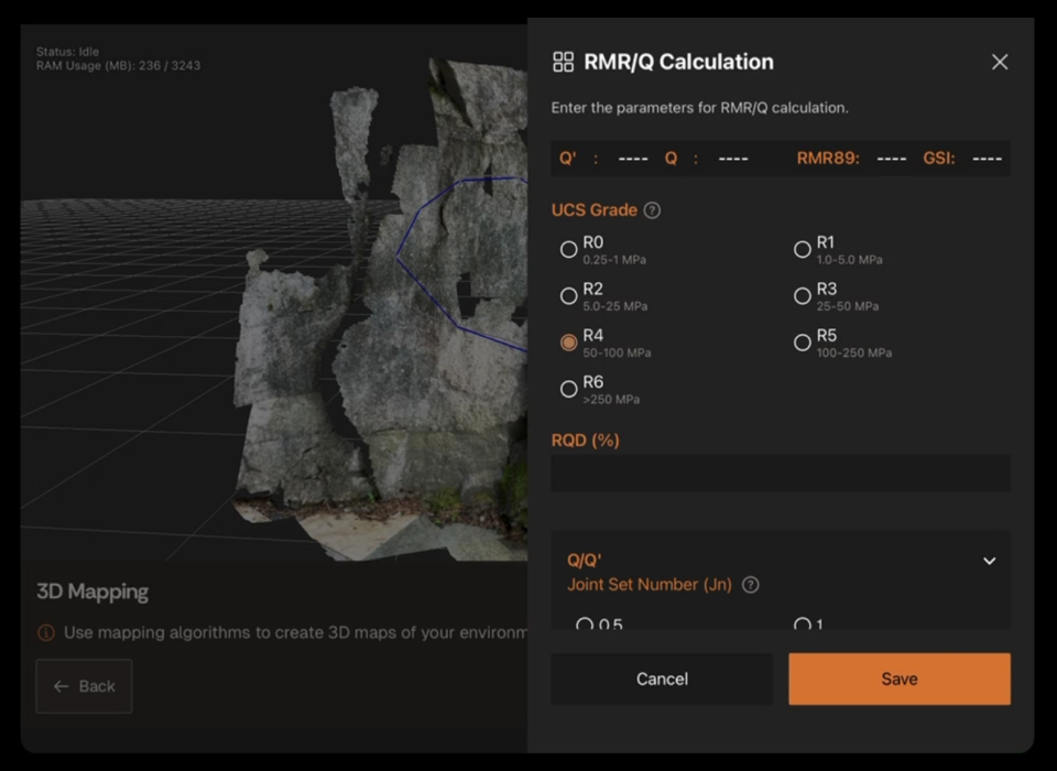

Historical dataset viewing means the previous assessment is visible alongside the current one.
Deterioration, corrosion, and visible convergence show up as patterns across assessments.


Repeatable 3D capture underground. Same framework, same conventions, same spatial context focused on geotechnical parameters and ground support condition across every assessment.

Historical dataset viewing make the assessment record a time series, not a pile of snapshots. Strata is where geotechnical and ground support conditions can be compared over time.
A continuous ground condition record across the site. Changes in ground conditions are visible as trends, not as one-off surprises. Earlier detection of deterioration and damage. Support-system reviews grounded in comparable, time-sequenced data.

Data captured in Lithos flows directly into the Grounded platform, where teams can review conditions, generate reports, and align on decisions.


We'll walk through an assessment workflow demonstrating a comparable historical dataset.

© 2026 GroundedAI. All rights reserved.
Vancouver, BC · EN


