NEWSLETTER


A dataset with georeferencing and mapping becomes a dataset where downstream decisions including modelling and assessments, can be trusted.
Datasets that are not tied to a specific location can't be exported into downstream models or analysis tools. Datasets that are not fully attributed cannot be used for deeper analysis or record keeping. What's observed underground needs to be easily classified and georeferenced to keep up with decisions at the pace of production.

Manual georeferencing is slow, error-prone, and often skipped. Data lands in folders organized by date or camera, not by location and the spatial continuity that should make the record searchable.
Mapping is done on a variety of platforms that only specific teams have access to. Data siloes create confusion across teams and escalate costs.
Two stages. Two products. One connected workflow from underground to decision.
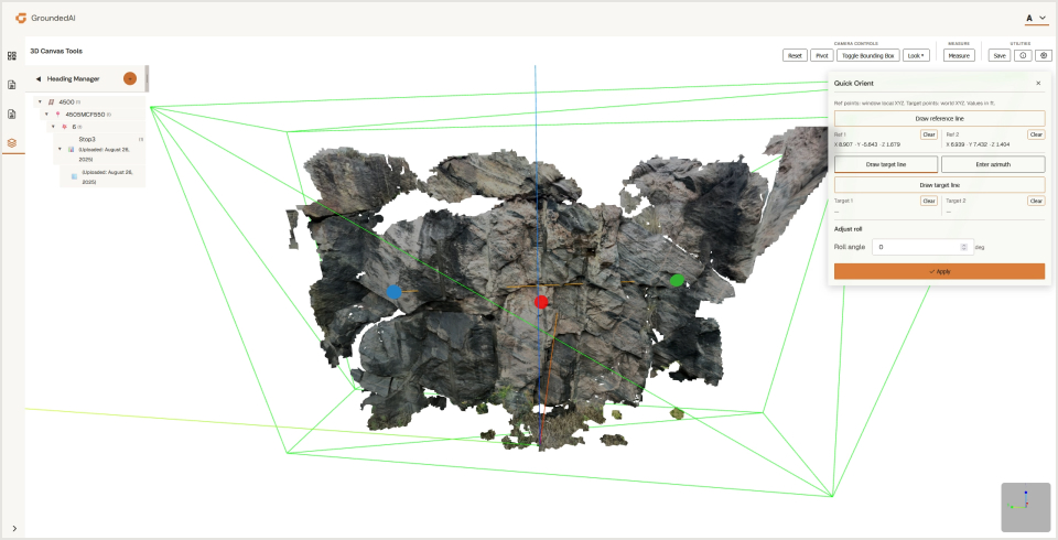
Intuitive georeferencing using quick orientation tools, survey markers, visual alignment, and round-naming conventions. Spatial reference baked into the record.

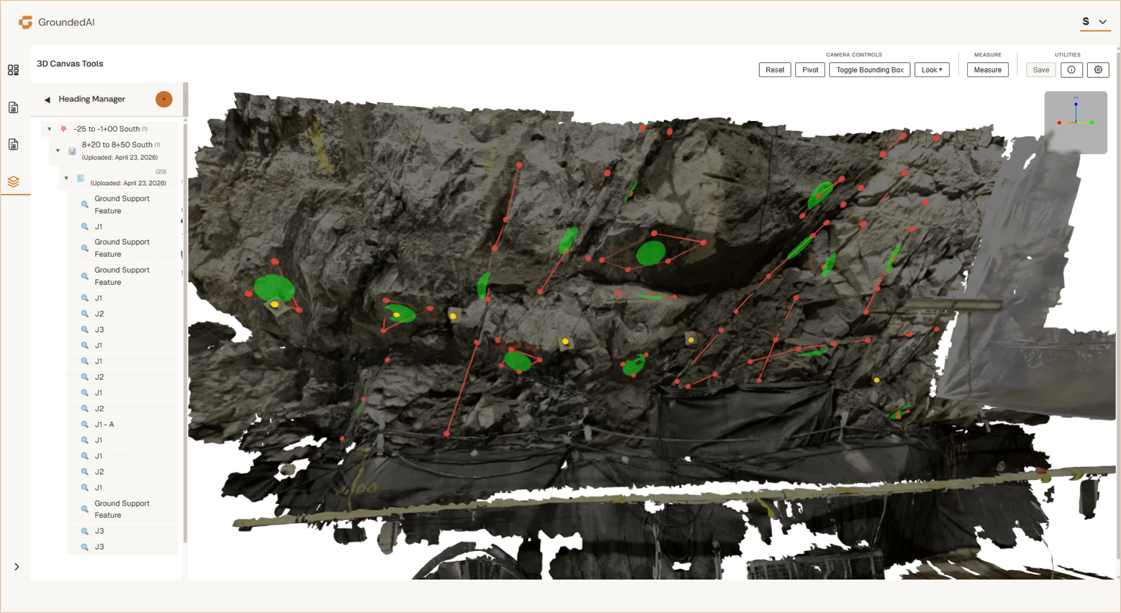
3D canvas with annotations, and classifications. Calculate structural orientation and spacing/distance measurements.

Strata's core functions focus on mapping within a 3D canvas. Datasets are georeferenced and mapped based on what was captured in Lithos or external 3D datasets.
Data searchable by location, date, observer, or classification that can be easily used for record keeping, report generation, modelling, and further analysis.

Data captured in Lithos flows directly into the Grounded platform, where teams can review conditions, generate reports, and align on decisions.


Walk through a mapping workflow with a real project dataset.

© 2026 GroundedAI. All rights reserved.
Vancouver, BC · EN


