NEWSLETTER

%20-%20Banner.png)

The geological record is the foundation under every downstream decision. Grade control. Excavation sequencing. Quarterly production targets When the record is fragmented, every decision that depends on it is impacted.
Mapping isn't a report written later. It's the live dataset that should inform production as it happens.


Traditional mapping relies on paper or disconnected devices, leading to transcription lag and lost spatial context. Because the flow of data from the field to the office is manual and slow, the 3D geological model is always struggling to catch up to the active production face.
Five stages. Two products. One connected workflow from face to decision.
Determine active headings and star them in Lithos for quick access. Configure Lithos for your site specific geology features and metadata.


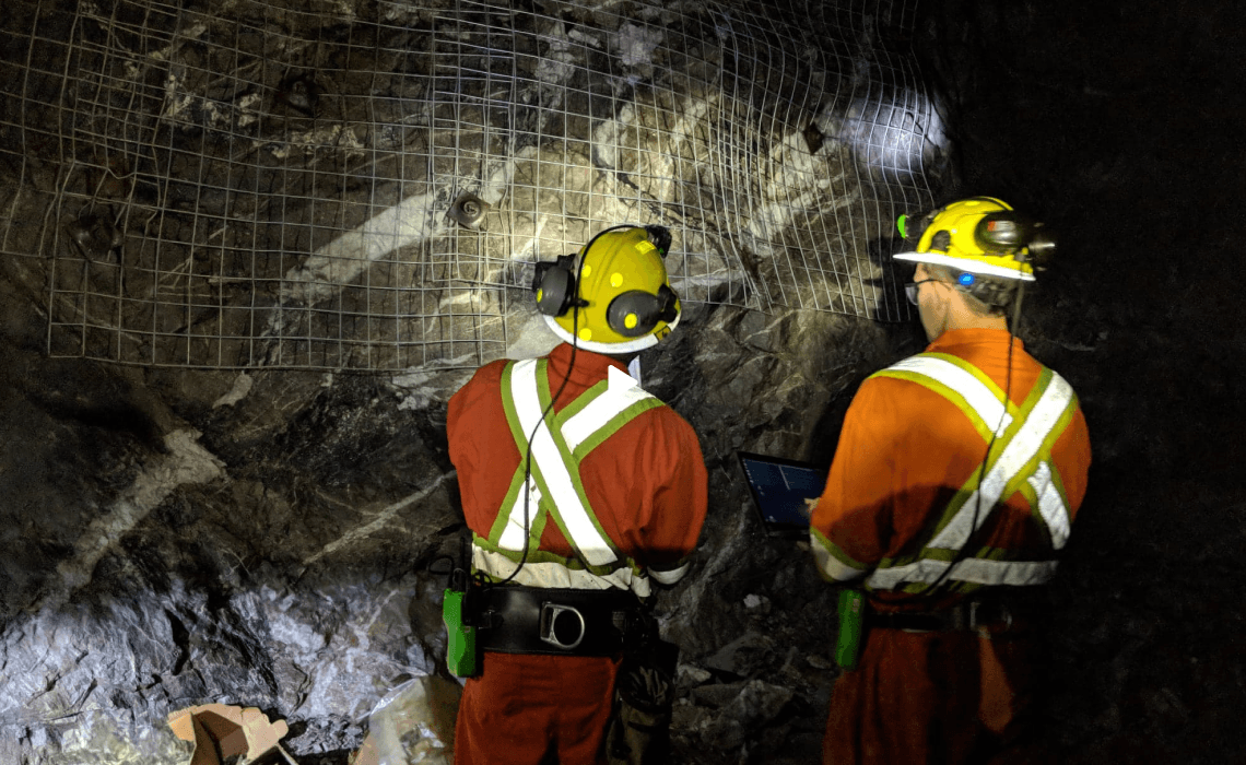
Location-based 3D scan in minutes or capture and annotate on an image if you're short on time.
Georeferenced, organized, searchable. Structural features, lithological contacts, and geological interpretations annotated directly on the 3D mesh.

%20-%20Stage.jpg)
Review geological interpretations and make decisions on all active faces. Generate face mapping reports that are easily sharable for mining teams in the next shift.
Export to Leapfrog Geo, Deswik, Vulcan, or in open formats (DXF, CSV) for any downstream modelling or analysis software.


Captures the geometry and the raw visual geological record. Lithos was designed for underground production. Face scans, quick photos, and easy to access location IDs. Every observation is accurately time-stamped and automatically funnelled into a structured location hierarchy, ensuring field data is organized before it ever leaves the heading.

Strata is the centralized platform where structured field data is anchored to the mine's coordinate system. It serves as the permanent geological record where feature observations are created and refined, reports are generated, and validated datasets are exported to downstream modelling software.
Structural annotations, lithological boundaries, channel sampling records, rock classifications. 3D geological datasets ready for modelling software or open-format export. A project-wide geological record that stays current with the production faces.

Data captured in Lithos flows directly into the Grounded platform, where teams can review conditions, generate reports, and align on decisions.


Walk through a geological mapping workflow with your project in mind.

© 2026 GroundedAI. All rights reserved.
Vancouver, BC · EN


