NEWSLETTER


Every advance within the tunnel requires a ground classification and support class decision. In theory, the ground conditions should match the baseline. In practice, the gap between the two is where most excavation support disagreements lie. Walking into a Required Excavation Support meeting with sketches and incomplete data contributes to how projects end up with difficult to prove project decisions and inconsistent records. Validation isn't a checkbox. It's whether the engineer making the critical support decisions can visualize and understand the realities of actual conditions.

RES meetings happen under time pressure with incomplete data. Photos with different lighting. Notes from different people. Memory filling in what wasn't written down. The engineer running the review spends an hour assembling data to prepare for the meeting. Decisions get made with imperfect data, because that’s the best they have.
Three stages. Two products. One connected workflow from face to decision.
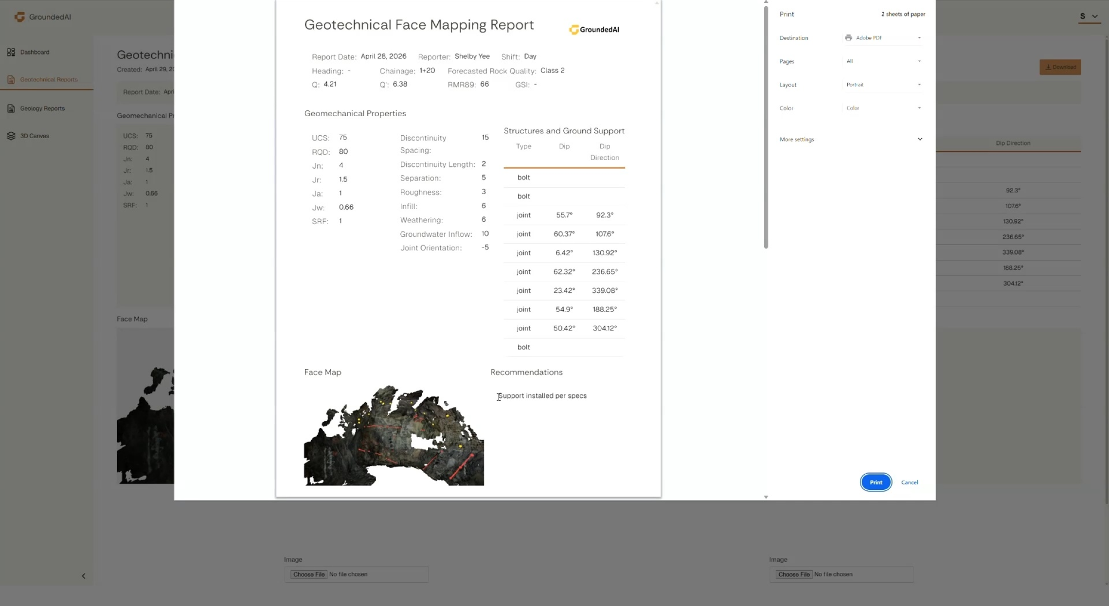
Lithos records underground data in 3D with geotechnical observations, rock mass classifications, and discontinuity data in context.


Every observation is organized, georeferenced, and review-ready. Historical dataset viewing allows for monitoring and comparison of changing ground conditions.
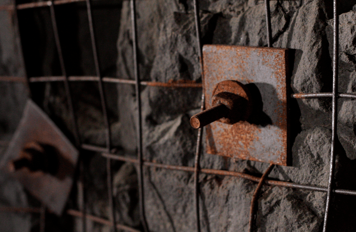
Annotated 3D models that align geology and geotechnical teams and decision makers on actual ground conditions, not from memory and hand sketches.


RES meetings are where decisions are made. Strata holds the visual record of current ground conditions, historical captures, annotations, and rock mass classifications connecting each ground observation and decision to its source. When the support decision is made, everyone in the room can look at the same evidence. Lithos generates data for Strata. Every ground condition captured in Lithos becomes part of the Strata database.
In a RES meeting every decision traces to a specific location, a specific date, and a specific observer. Support class decisions made with objective data, not assumptions. A persistent record of validation that strengthens project review and disputes.
Data captured in Lithos flows directly into the Grounded platform, where teams can reviewconditions, generate reports, and align on decisions.


We'll walk through an RES meeting workflow end to end, from face capture to support-system decision.

© 2026 GroundedAI. All rights reserved.
Vancouver, BC · EN


