NEWSLETTER


Incomplete records, missing timestamps, gaps in the chain of custody weaken supporting arguments. The lack of a complete and coherent record can drag out the resolution to a claim by years.
The record isn't assembled at the end. It's built every day.

Most projects don't piece together the DSC package until they need it. Photos in folders. Sketches in notebooks. Observations in Teams chat threads. When a DSC becomes a claim, the project team spends weeks or months reconstructing what should already exist, and the end result is often riddled with gaps, ambiguity, and inconsistencies.
The claim is as defensible as the record. The record is as defensible as the process that built it.
Three stages. Two products. One connected workflow from face to decision.
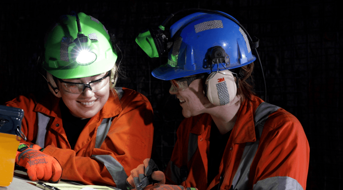
Capture records in 3D colour with timestamps and observer meta data.
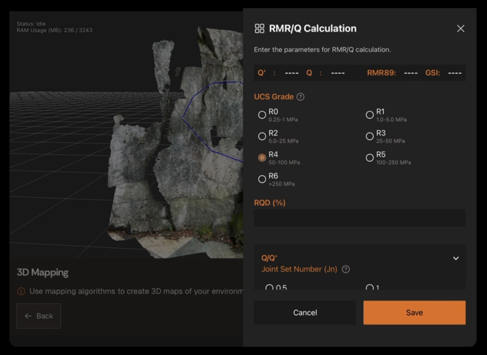

Every record is structured and georeferenced. View ground conditions as they change over time and across the tunnel profile.
When a DSC claim is needed, the evidence is already there. Assembling or defending the datasets that supports the claim is easy to retrieve and work with.

Where plan meets reality. A consistent digital history of ground conditions that can keep up with the pace of production. Every observation captured in Lithos becomes part of the Strata record. The record doesn't get assembled, it accumulates. The state of the project at any point in time is easily accessible.
When a manager needs evidence, they query the record.
A complete project record with observation timestamps and a clear chain of custody. Truly contemporaneous DSC documentation that strengthens an argument in dispute. Claim packages built in days, not months.

Data captured in Lithos flows directly into the Grounded platform, where teams can review conditions, generate reports, and align on decisions.


We'll walk through a documentation workflow that adds strength in disputes.

© 2026 GroundedAI. All rights reserved.
Vancouver, BC · EN


